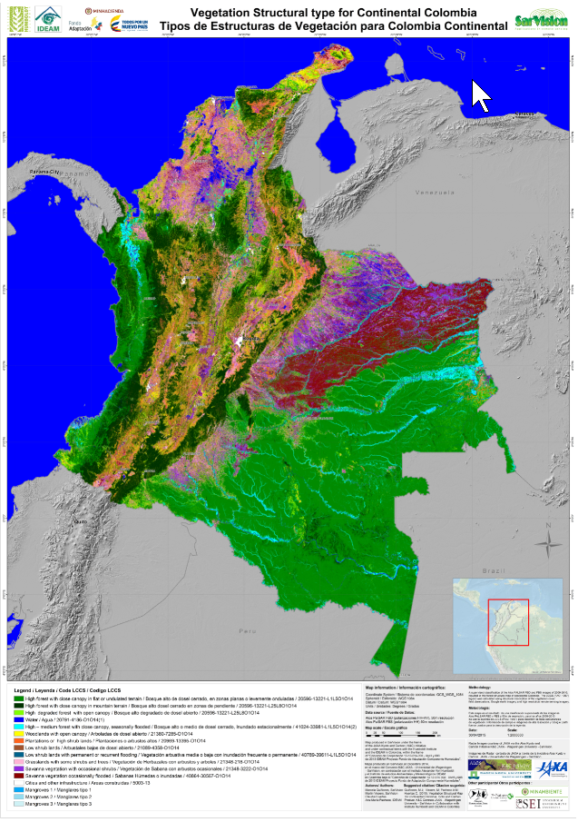
Land Cover and Biomass mapping
A solid Baseline is the best starting point for detecting changes.
By integrating optical and radar imagery in combination with our state of the art algorithms and in house expertise, SarVision creates accurate land cover and biomass maps for entire countries and large regions. The maps are made according to international standards
.
